 (P) (P)Shelf cloud Cocoa Beach, FL 1986
|
 (V) (V)Under shelf cloud Gray Co., TX 5/23/97
|
 (V) (V)Supercell with wall cloud Harper Co., KS 5/25/97
|
 (P) (P)Tornado Harper Co., KS 5/25/97
|
 (V) (V)Tornado, rope phase Harper Co., KS 5/25/97
|
 (P) (P)Bell-shaped updraft Harper Co., KS 5/25/97
|
 (V) (V)Funnel Near Wellington, KS 5/25/97
|
 (V) (V)Wedge tornado Perth, KS 5/25/97
|
 (V) (V)Wedge tornado Perth, KS 5/25/97
|
 (V) (V)Wall cloud near Beggs, OK 5/26/97
|
 (V) (V)Tornado near Beggs, OK 5/26/97
|
 (V) (V)Tornado near Preston, OK 5/26/97
|
 (V) (V)Funnel near Preston, OK 5/26/97
|
 (V) (V)Tornado ("hose") near Preston, OK 5/26/97
|
 (P) (P)Supercell Western TX 5/28/97
|
 (P) (P)Tornadic supercell near Coatesville, VA 4/1/98
|
 (P) (P)Shear funnel east of Emporia, VA 6/15/98
|
 (V) (V)Roll cloud Charlottesville, VA 6/16/98
|
 (V) (V)Wall cloud (not tornado) near Waverly, VA 3/03/99
|
 (P) (P)Mammatus West TX 5/21/00
|
 (V) (V)Severe storm West TX 5/21/00
|
 (V) (V)Lightning Norman, OK 5/25/00
|
 (P) (P)Severe storm Vega, TX 5/25/00
|
 (V) (V)Left splitting supercells south of Seymour TX 5/26/00
|
 (V) (V)rotating ?wall cloud Throckmorton, TX 5/26/00
|
 (V) (V)funnel & rotating wall cloud Throckmorton, TX 5/26/00
|
 (V) (V)Brief tornado Throckmorton, TX 5/26/00
|
 (V) (V)Storm chasers Throckmorton, TX 5/26/00
|
 (V) (V)Funnel Jacksboro, TX 5/27/00
|
 (P) (P)Roll cloud Dallas, TX 5/27/00
|
 (V) (V)Rare double roll cloud Richmond, VA 8/9/00
|
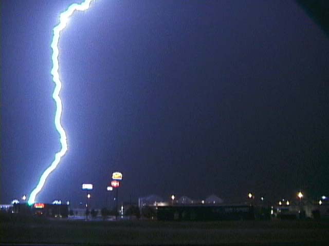
 (V) (V)Close lightning strike Childress, TX 5/19/01
|
 (V) (V)Funnel cloud near Red Oak, OK 5/20/01
|
 (V) (V)Gust front approaching Sublette, KS 5/27/01
|
 (V) (V)Horshoe vortex central Kansas, 5/22/02
|
 (V) (V)Dusty tornado near Lipscomb, TX, 5/23/02
|
 (V)
(V) (V)
(V) (P)
(P) (V)
(V) (V)
(V) (V)
(V) (V)
(V) (V)
(V) (P)
(P) (P)
(P) (V)
(V) (P)
(P) (P)
(P) (P)
(P) (V)
(V) (V)
(V) (P)
(P) (V)
(V) (V)
(V) (P)
(P)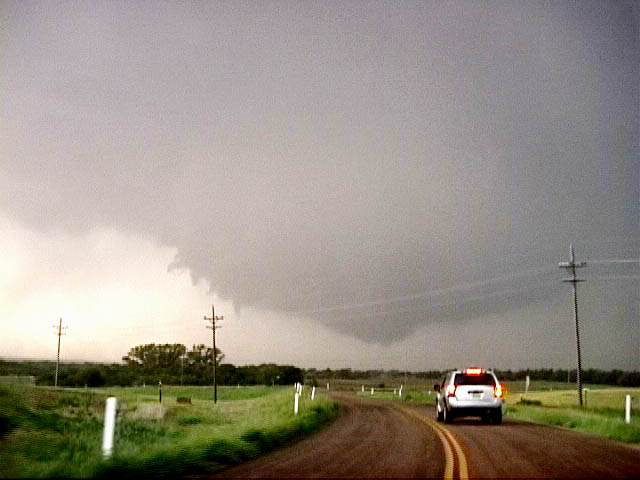 (V)
(V) (V)
(V) (P)
(P) (P)
(P) (P)
(P) (P)
(P) (P)
(P) (P)
(P) (P)
(P) (P)
(P) (P)
(P) (P)
(P) (P)
(P) (P)
(P) (P)
(P) (P)
(P) (P)
(P) (V)
(V) (P)
(P) (P)
(P) (P)
(P) (V)
(V) (V)
(V) (V)
(V) (P)
(P)