(1)
(2)
(3)
(4)
(5)
(6)
(7)
(8)
(9)
(10)
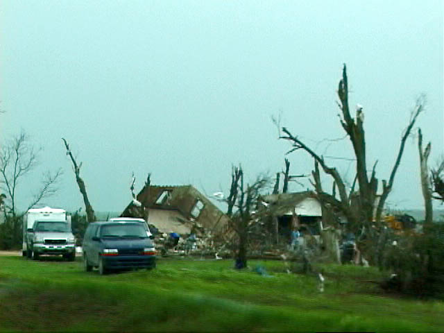
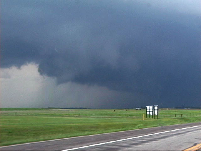
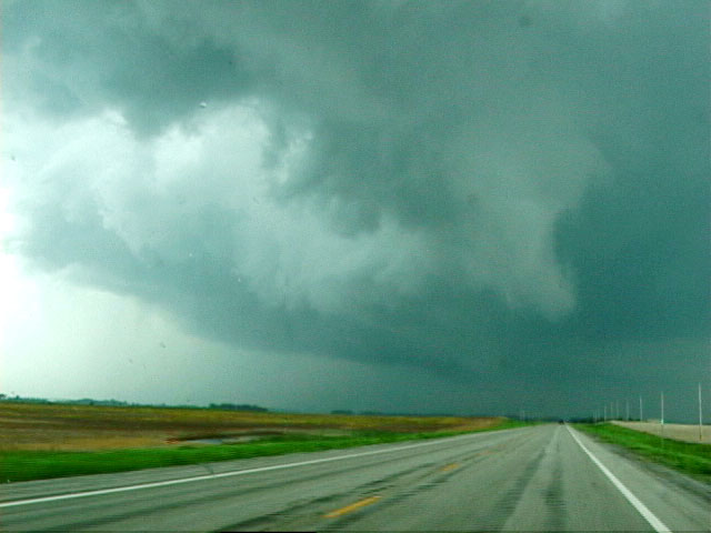
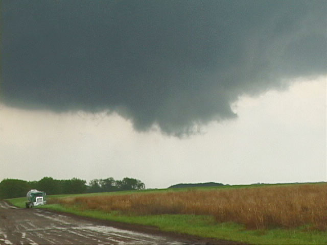
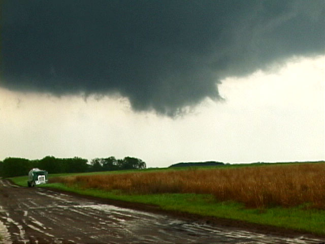
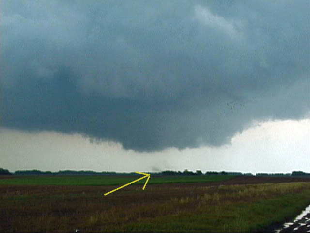
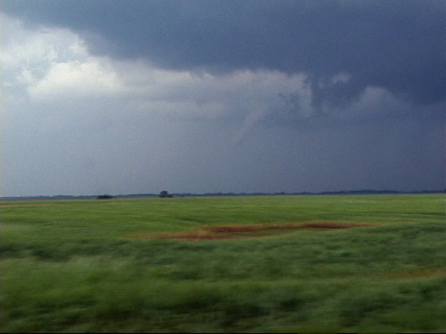
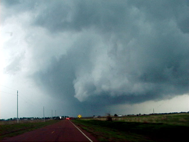
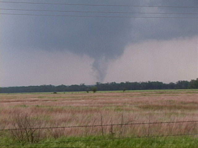
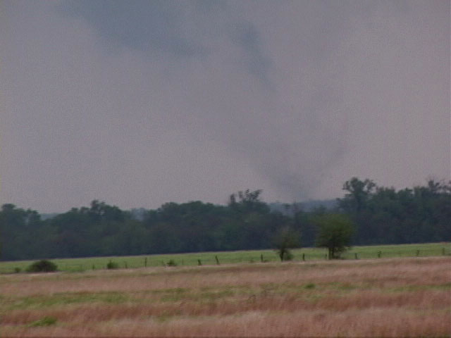
I left Richmond at 6AM and was supposed to arrive in Wichita, KS by 10:30AM. The flight from Atlanta was delayed by an hour. While at the airport, I talked with Matt Crowther, a meteorologist from The Weather Channel who was also flying out to chase. I arrived, picked up the rental and was on the road by about noon. I drove west on 54 and was able to stop and get data in Kingman. With high instability, backed surface winds and upper level support, severe storms could develop anywhere along the dryline. The storms would be moving quickly to the northeast. I was hoping for more isolated storms to the south. Unfortunately, storms were already forming in the early afternoon near Dodge City in a north-south line. In Pratt, I turned north on 281, then west on 50. The main westerly road from Pratt (State Road 54) was blocked after the devastating tornado that hit Greensburg, and I had to take a big detour. While heading west on 50, I passed an area of tornado damage (1) several miles east of Macksville from the previous night. (This same area would have more tornado damage Saturday night.) The initial storms were linear, but I could see some better development to the south. I turned south on 183 then east on 160 to intercept a more isolated storm on the KS-OK border that was moving northeast. I had wanted to meet up with Dave Lewison and Scott McPartland, but we all wanted to intercept the storm from different approaches. The storm was moving a bit more quickly, and I got behind it. Construction on 160 slowed my progress. I turned north in Medicine Lodge and hoped to get near the storm around Pratt. The storm still didn't look good on radar but it was better than anything else. Visibility was poor due to haze. At about 4:35 PM CDT, I was complaining about all the linear storms to Jim Leonard on the phone when suddenly the NWS issued a tornado warning for the storm I was following. I blasted north on 281. Dave and Scott, who were already near the storm, could see a wall cloud just north of Pratt and near Stafford, Kansas. After a brief delay in Pratt at 4:42 PM, I continued north. I could see the rotating wall cloud (2). It was to my northwest. I slowed and allowed it to pass in front of me (3). I carefully continued north watching for hail and RFD. Finding a non-muddy east option was difficult. At 5:12 PM, the wall cloud (image 4) and (image 5 views to the east) was more defined and rapidly rotating. There was a dust whirl under the now larger wall cloud at 5:17 PM near Stafford. (View form 281 and SE 60th ST(6) This was the first tornado. There was no condensation funnel. I am surprised a larger tornado didn't form. I continued north on 281, then east on 50 to keep up with the rapidly moving storm. Once east of the storm, I turned north. I saw a brief funnel (7) to the east at 5:47 PM while on County Road 140 also heading north. The storm continued to produce a rotating wall cloud and brief funnels. I headed north on Raymond Rd. At 6:02, the storm was due north of my location and shifting east. (View from Raymond Rd. looking north (8).) I turned east on 95 and north on Sylvia Rd (4th Rd). There were large numbers of chasers along the sides of the roads and following the storm. With increased storm motion and rotation, I pulled off of Sylvia Rd unto AV U to view the storm. The storm produced a brief tornado with a debris cloud. (View toward Raymond in Rice County at 6:16 PM (9)). (Close-up of debris (10).) Rapid cloud rotation continued but no additional tornadoes. At this point, I decided to bag this storm and head west on 56 to investigate a large tornadic storm approaching Great Bend. There were more storms to the south of Great Bend in a line, moving north, and becoming tornadic. Unfortunately, I spent too much additional time with the first storm. The initial Great Bend storm had already produced one tornado to the southwest of the town. I blasted west toward the storm, then northeast on 156. A wall cloud apparently passed over Great Bend but visually the storm was not impressive. I watched the storm from the Cheyenne Bottoms area as darkness approached. By now, I had heard of massive tornadoes to the south but visibility was to low to safely attempt another intercept. I did shift eastward and waited for another tornado-warned storm to pass over Great Bend.
Since it was dark, I decided to drive back to Wichita to catch my 7:30AM flight. It was too late to meet up with Dave and Scott. I did talk with some chasers from Florida and Denmark (Florida Based Storm Trackers FBST) who had some amazing stories about following the horrific Greensburg tornado. Although I didn't see the St. John, Kansas wedge, I was happy to see a couple of tornadoes. This was a successful storm chase to initiate the 2007 season. Hopefully, any additional tornadoes will stay away from populated areas. Total driven miles: 531.
|
(1) |
(2) |
(3) |
(4) |
|
(5) |
(6) |
(7) |
(8) |
|
(9) |
(10) |
. | . |
All images video stills.
Return to Storm Chase Accounts and Images